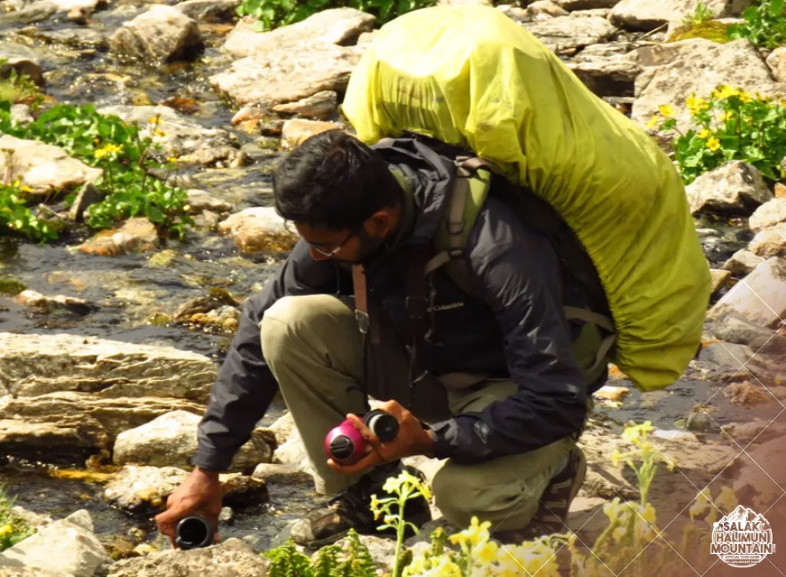
salakhalimunmountain.com – Trekking through the sprawling rainforest wilderness of Mount Salak and Halimun National Park plunges you into a dense, multi-layered world where the sky is often hidden behind thick green canopies. When navigating these intricate mountain complexes, traditional visual landmarks like distant peaks or open valleys are rarely visible. In deep tropical interiors where dense foliage blocks the horizon, the mountain’s network of mountain streams and rivers becomes your most reliable natural compass. Learning how to use river flow direction to find Salak trails provides a life-saving navigational anchor when paths fade or visibility drops.
To the uninitiated, a jungle stream might look like an impassable obstacle or a random flow of water. However, water on a volcanic massif like Mount Salak follows strict laws of physics and gravity. Every drop of rain that falls on the upper slopes gathers into high-elevation gullies, trickles into minor tributaries, merges into roaring mountain streams, and ultimately drains out toward lowland river basins where human settlements and established trailhead networks reside. By understanding how drainage networks form, how trail builders interact with watercourses, and how to safely follow stream channels, you can read the mountain’s hydrological map to orient yourself and relocate established paths.
The Anatomy of Mount Salak’s Hydrological Network
To use river flow for navigation effectively, you first need to visualize the physical structure of Mount Salak’s drainage systems. Mount Salak is an eroded stratovolcano characterized by steep, radial drainage patterns. Imagine an umbrella: water falls on the central peak and flows outward in all directions like spokes on a wheel, carving deep ravines and valleys as it descends toward the surrounding plains of Bogor and Sukabumi.
High near the ridge tops, water begins as minor trickles or seasonal seepage channels called headwaters. As you move downhill, these tiny channels converge into steep gullies, which then feed into permanent mountain streams (anak sungai). Eventually, these streams join main rivers like the Ciapus, Cikuluwung, or Cisadane. Because water flows strictly downhill from narrow high-altitude catchments to wide lowland valleys, following a stream downhill almost always leads toward lower elevations, broader valleys, and eventually human infrastructure.
Distinguishing Upstream vs. Downstream Navigation Logic
When using river flow to navigate, direction is everything. Descending along the direction of flow (downstream) generally leads you toward lower elevations, warmer air, civilization, and major trail exits. Following a stream against its flow (upstream) leads you higher up into narrower, steeper, and more remote mountain catchments.
However, descending a stream is not a blind guarantee of an easy walk. Near the upper reaches of Mount Salak, young streams often plunge over sheer volcanic cliffs, forming hidden waterfalls and impenetrable gorges. The key is using the river’s flow direction as a spatial orientation vector rather than treating the riverbed itself as a paved walking highway.
How Trail Builders Utilize Watercourses
Human geography in tropical mountains is intimately tied to hydrology. Indigenous communities, forest rangers, and early trail builders did not lay out trekking routes randomly; they followed the natural contours carved by water and topography. Understanding this relationship helps you locate where established trails intersect with river networks.
In the steep terrain of Halimun Salak, official trekking trails frequently parallel major stream valleys. Valleys offer gradual gradients compared to vertical cliff faces, and watercourses provide vital water sources for traditional campsites. However, trails rarely sit directly in the riverbed due to flash flood risks. Instead, established paths typically run along the elevated benches, spur ridges, or natural terraces parallel to and 20 to 50 meters above the stream floor.
Identifying River Crossing Points and Trail Intersections
When a trail needs to cross from one ridge system to another, it inevitably drops down to cross a stream at its safest, shallowest point. These crossing zones leave distinct visual marks along the riverbanks that you can spot if you are looking for them.
Look for areas where the river valley widens and the water velocity slows down, often characterized by gravel bars or flat stepping-stone arrangements. Scan the riverbanks for flattened embankments, cut branches, foot-scuffed rocks, or exposed tree roots cleared of moss. Finding a localized concentration of worn rocks or an obvious break in the dense bank vegetation usually indicates a trail crossing, allowing you to step out of the riverbed and back onto a clear, marked path.
Safe Techniques for Tracking Stream Valleys
If you find yourself off-trail under a dense canopy and decide to use a stream’s flow direction to guide you back to civilization, execution is critical. Venturing directly into a wet, slippery riverbed can expose you to flash floods, hypothermia, and dangerous falls on wet volcanic basalt.
Avoid walking directly in the water whenever possible. Instead, practice “ridge-bench tracking”—walking along the elevated terrain just above the stream’s flood line. Maintain visual or acoustic contact with the river so you can hear its flow direction, but stay high enough on the valley slope to avoid slippery, algae-covered boulders, deep pools, and sudden gorge drop-offs.
Navigating Around Waterfalls and Impasses
As you follow a stream downstream, you will inevitably encounter topographic impasses such as waterfalls, logjams, or sheer rock walls. When the riverbed suddenly drops into a vertical gorge, never attempt to climb down wet cliff faces or jump into unverified pools below.
The moment the river terrain becomes impassable, execute a wide high-side bypass. Backtrack 20 to 30 meters upstream, climb higher up the valley side slope onto a stable spur, and traverse around the waterfall at a safe elevation. Once you are past the cliff edge, angle gradually back down toward the river valley downstream of the obstacle, using the sound of the flowing water to guide your descent back into the main drainage corridor.
Cross-Referencing River Vectors with Navigational Tools
Using river flow direction is most effective when combined with basic navigational tools. A river provides a dynamic, physical line on the ground, but cross-referencing its direction with a magnetic compass or topographic map turns a simple line into an exact position fix.
Mount Salak’s major rivers flow in specific cardinal directions depending on which face of the mountain you are on. For instance, streams on the northern slopes flow toward Bogor (north), while drainages on the southern and eastern flanks flow toward Sukabumi and Lido (south/southeast). By taking a compass bearing along the stream’s downhill flow, you can immediately determine which sector of the mountain you are descending, matching the stream’s orientation with contour lines on your map.
Recognizing Tributary Confluences for Position Verification
As you travel downstream, pay close attention to stream junctions, known as confluences. A confluence occurs where a smaller side tributary merges into the main stream channel. Topographic maps mark these Y-shaped intersections clearly.
When you reach a confluence, note the angle at which the side stream enters the main flow and take a quick compass reading of both channels. Identifying a distinct confluence on your map gives you a precise point reference, confirming your exact altitude and distance along the valley. From there, you can consult your map to see how far ahead the next official trail crossing or park boundary lies.
Respecting Tropical Hydrology and Flash Flood Safety
While rivers are invaluable navigational guides, tropical watercourses demand immense respect. Rainforest storms on Mount Salak’s upper peaks can drop torrential rain in minutes, triggering rapid water surges known locally as *banjir bandang*. A clear, gentle stream can transform into a muddy, raging torrent in a matter of moments.
Always stay alert to environmental warning signs when tracking along a stream. If the water suddenly turns murky or brown with suspended clay, if you notice floating debris and leaves increasing rapidly, or if you hear a deep, roaring sound from upstream, immediately move to high ground. Climb at least 10 to 15 meters up the valley side slope and wait out the surge on a secure ridge bench. Prioritizing flood safety ensures that using the river as your guide remains a secure, reliable strategy.
Mastering the ability to read river flow direction transforms Mount Salak’s vast water network from a confusing maze into a natural roadmap. By combining hydrological logic, keen observation of trail-crossing indicators, and smart terrain choices, you can navigate through the thickest rainforest canopies with confidence, spatial awareness, and deep respect for the living mountain landscape.
So, if you’re ready to explore the wonders of Mount Salak Halimun, head over to our ONLINE BOOKING PAGE and let’s start planning your adventure. Or simply CLICK THIS LINK to chat with us on WhatsApp.
With our team, you’re not just getting a guide; you’re gaining a local friend who will ensure your trip is nothing short of extraordinary.